The Manaslu Trek is a beautiful adventure that will lead you to the most beautiful trekking paths in the world. The scenic landmarks of the region will enchant you to the core. Trekking through the picturesque landscapes of the area will delight any traveler.
One of the first things you need to ensure is that the itinerary you set for the trek is perfect. You will go through the most rugged terrains in the Manaslu region. Hence, an ideal map along with the itinerary will ensure that the tour remains safe and comfortable.
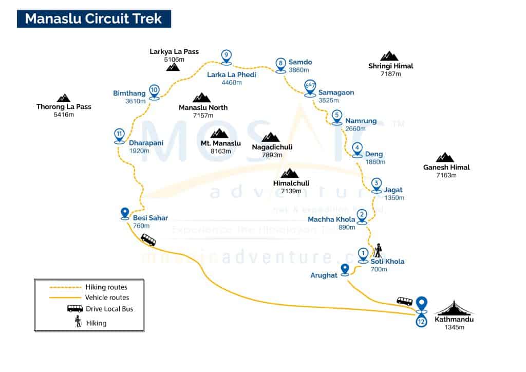
The Manaslu Trek Map is essential information that will help you trek the region’s serene terrains without any hassle. The beautiful trail will lead you through the incredible landscapes of the area.
There are also side trips and acclimatization points to the region, allowing you to take side steps and explore purposes. You will also get information about the maximum altitude, total distance covered, trek duration, and others. Read on to learn more about the Manaslu Trek Map in detail.
Table of Contents
- Manaslu Circuit Trek Map
- Manaslu Tsum Valley Trek Map
- Kathmandu – Soti Khola.
- Soti Khola – Machha Khola.
- Macha Khola – Jagat
- Jagat – Philim – Lokpa
- Lokpa – Dumje
- Dumje – Milereppa cave – Nele
- Nele – Mu Gompa
- Mu Gompa – Rachen Gompa
- Rachen Gompa – Chumling
- Chumling – Lokpa.
- Lokpa to Namrung
- Namrung – Lo-Gaon
- Lo-Gaon – Sama-Gaon
- Sama-Gaon – Samdo (3,690 m)
- Samdo – Larkya Phedi/Dharma-Shala
- Larke Phedi – Larke La Pass – Bhimthang
- Bimthang – Dharapani
- Dharapani – Chamje – Besisahar.
- Besisahar – Kathmandu
Manaslu Circuit Trek Map
Kathmandu – Soti Khola
Soti Khola altitude: 700m
Drive duration: 7-8 hours
Overnight: Soti Khola
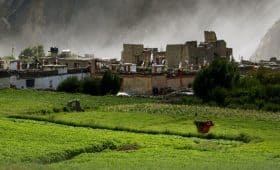
Manaslu Circuit Trek begins with an outstanding drive from Kathmandu to Soti Khola. You will pass through the scenic trails through the region’s winding highways. There are scenic paths, including the terrace, farmed hills, waterfalls, etc. You will cross the Arughat Khola and Arukhet Bazaar along the trail. Soti Khola is another settlement where you will arrive at the end of the journey, which takes around 7-8 hours.
Soti Khola – Machha Khola
Machha Khola altitude: 863m
Trek duration: 6-7 hours
Overnight: Machha Khola
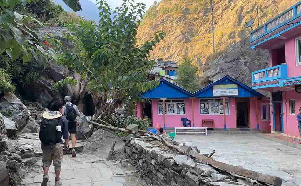
The trekking journey starts from Soti Khola, passing the serene terrains to arrive at Macha Khola. You will trek through the beautiful trail that ascends uphill along the Sal forests. The trail then leads you to the settlement of Labubesi (885m), passing through the rice paddies. There are suspension bridges along the Nauli Khola Falls that you will cross. The descending trail will lead you through the river banks in the Machha Khola village settlement.
Macha Khola – Jagat.
Jagat altitude: 1350m
Trek duration: 7-8 hours
Overnight: Jagat
This section of the trek trail passes through incredibly narrow paths. You will trek alongside the Budhi Gandaki river. The trekkers will pass through Dobhan, Shyaule Bhatti, and others to finally arrive at Yaru.
The beautiful views of scenic Budhi Gandaki will enchant you, and you can observe lovely cascades. After trekking incredible landscapes for a few hours, you will arrive at Jagat, which has stone-paved streets. There are basic accommodation facilities and a campsite too.
Jagat – Deng
Deng altitude: 1350m
Trek duration: 7-8 hours
Overnight: Deng
These trek trails of the region will lead you through the narrow paths alongside the cliff and the serene Budhi Gandaki river. You will trek through the numerous terrains of the area, passing through the settlements of Dobhan, Shyaule Bhatti, and Yaru. The trail then turns scenic alongside the Budhi Gandaki river. The lovely cascades of the region are pretty enchanting. After a few hours of trek, you will finally arrive at Deng.
Deng – Namrung
Namrung Altitude: 2630m
Walking hours: 6-7 hrs
Overnight: Namrung
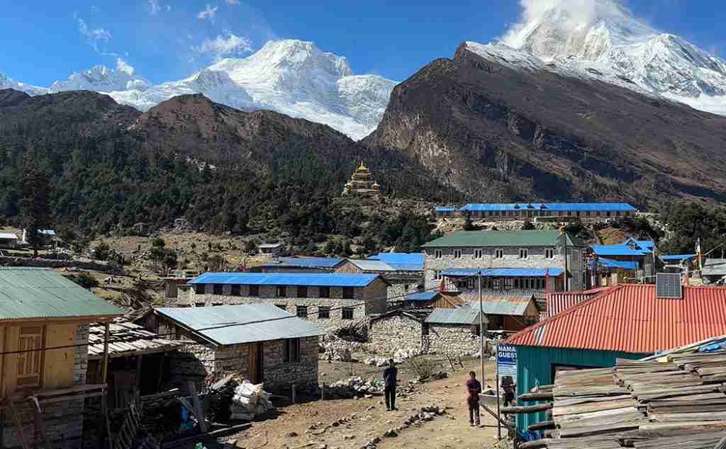
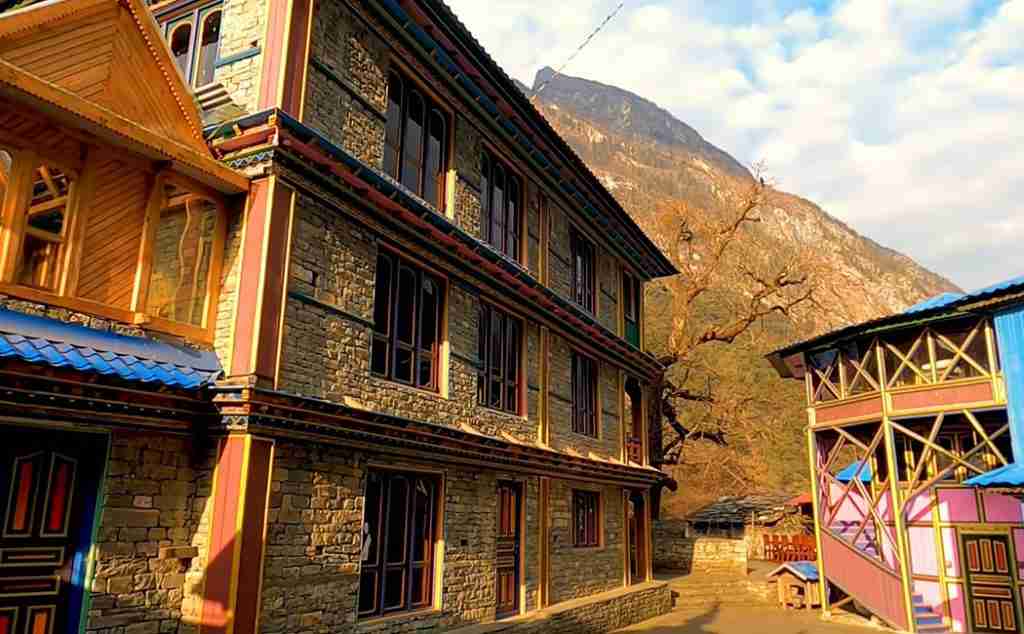
The beautiful destination of Namrung is around 5-6 hours from Deng. There are many Mani walls along the trail with Buddhist stone carvings. Bamboo forests along the trail provide a tranquil atmosphere in the region. After trekking for a few hours, you will arrive at the settlement of Namrung. You can stay overnight in many tea houses and stone houses in Namrung.
Namrung – Samagaon
Samagaon Altitude: 3350m
Walking hours: 6-7 hrs
Overnight: Samagaon
The Namrung to Shya journey is beautiful, passing through the Tibetan settlements. The trail then leads through Barcham, Li, Sho, and Shya territories. The scenic settlement along the region will make you fall in love with the place.
There are viewpoints in the region from where you can observe Himal Chuli, Manaslu, and other snow-clad mountains. The trail will then lead you through the serene terrains to arrive at your destination.
There are scenic terrains to traverse before arriving at the destination. You will pass through the smaller, narrower trails, making the journey tricky. The trail then passes through the canyon before reaching the pasture land.
Samagaon to Samdo
Samdo Altitude: 3860m
Walking hours: 4-5 hrs
Overnight: Samdo
The beautiful trail starts from Samagaon, passing through the forested areas of the region. There are also snow-clad mountains where you can observe Mt Manaslu. The route of this trek takes you through the Tibetan Refugee settlements. After arriving at the destination, you will spend the night at the teahouse.
Samdo – Larka la Phedi (Dharamshala).
Larkya Phedi Altitude: 4460m
Walking hours: 6-7 hrs
Overnight: Larkya Phedi
The trail starts from Samdo and passes through the scenic terrains of the Larkya La Phedi. The trail travels alongside the Gyala Khola. The trekkers will cross the river on a suspension bridge in the region.
There are mani stones and Buddhist heritage in the region. The trail also has a majestic vista of the Larkya Peak and Manaslu’s north face. After arriving at the Larkya Phedi, you will spend the night in the region.
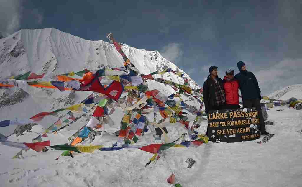
Larkya La Phedi – Larkya la Pass – Bimthang
Larkya La Pass Altitude: 4470m
Bintang Altitude: 3860m
Walking hours: 6-7 hrs
Overnight: Bintang
The trail in this section will lead you to Bintang from Larkya La Phedi. The best adventure of the region will enchant you along the route. You will pass through the Larkya la pass to arrive at the destination. On the trail, you will pass through the rocky moraine at 4690m.
The Larkya La Pass is a scenic point where you can observe the Himalayan vista. It includes various snow-clad mountains, including Annapurna II, Minjung, Himlung, and Cheo Himal. The trail then descends gradually before arriving at the Bintang.
Larkya La Phedi – Dharapani
Dharapani Altitude: 1860m
Walking hours: 6-7 hrs
Overnight: Dharapani
The trail will be enchanting as you trek from Larkya La Phedi to Dharapani. The beautiful trail passes through the pine and rhododendron forests of the region. The beautiful course will lead you to the Hompuk village settlement.
The trail passes alongside the region’s Dudh Khola and Marsyangdi River settlements. You will pass through the scenic trails and the territories of the Karcher, Tilije, and others before arriving at the Dharapani.
Dharapani – Besi Sahar – Kathmandu
Syange Altitude: 1080m
Walking hours: 7-8 hrs
Overnight: Syange
The scenic drive from Dharapani to Kathmandu will take you through the challenging landscapes of the region. You will pass through the scenic winding highways of the area. The beautiful drive also passes through the settlement of Besisahar. After driving for 7-8 hours, you will arrive at the destination of Kathmandu.
See also:
Manaslu Tsum Valley Trek Map
Kathmandu – Soti Khola.
Soti Khola altitude: 700m
Drive duration: 6-7 hrs
Overnight: Soti Khola
The first destination of the Manaslu Tsum Valley Trek is Soti Khola, where you arrive in Kathmandu. The scenic highway leads you through the Dhading district before climbing the hill to reach Arughat. You will pass through the rugged dirt roads gently through the Budhi-Gandaki River. Finally, you will arrive at the Soti-Khola settlements after driving for around 7-8 hours.
Soti Khola – Machha Khola.
Machha Khola altitude: 930 m
Trek duration: 5-6 hrs
Overnight: Machha Khola
The trek from the Soti Khola’s settlements passes through the hilly landscapes. You will pass through a forested area with many diverse terrains. After passing through these terrains, you will arrive at the valley.
There is a large tributary stream opposite the majestic Budhi-Gandaki River. Besides, there are various other incredibly diverse terrains, including the sandy riverbed, before you finally arrive at Machha Khola.
Macha Khola – Jagat
Jagat altitude: 1410m
Trek duration: 5-6 hrs
Overnight: Jagat
The Machha Khola trekking journey starts through the beautiful uphill terrain to arrive at the Khola-Besi. You can find Tatopani village settlement, a natural hot water spring along the trail.
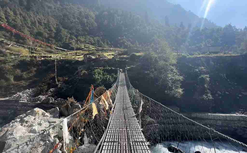
The trail then gradually becomes more profound and narrower as you pass through the left bank of the river. After crossing the suspension bridge through the alpine forest, you will arrive at the destination of Doban, lying next to the Budhi Gandaki River.
Our journey continues to the uphill terrain that will lead you to several water streams, which you cross through suspension bridges. You start descending trails after arriving at the higher-altitude valley of Yara Khola. The course of this trek continues through other moraines before you finally arrive at the ultimate destination of Jagat.
Jagat – Philim – Lokpa
Lokpa altitude: 2240 m
Trek duration: 6 hrs
Overnight: Lokpa
We will start our trek on this day early as we will need to cover much ground. At the start of our six-hour-long trip, you will first have breakfast in the Jagat teahouse. We will climb stone steps from Jagat to arrive at the water stream.
You can observe the spectacular view of the Shringi Himal (7,187m). That trek will then take you to the North-East region to arrive at Lokpa. It is a Tibetan village where you can find a teahouse to stay.
Lokpa – Dumje
Dumje altitude: 2,980 m
Trek duration: 6 hrs
Overnight: Dumje
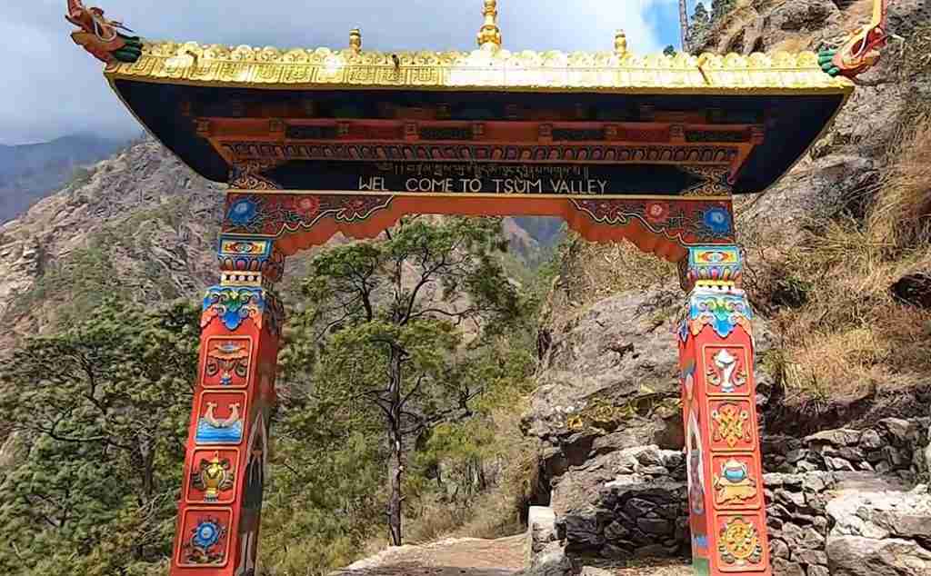
The terrains pass through remote settlements with distinctive features different from the other parts of the region. You will enter this Tsum “valley of happiness” during this trek section.
There are various farmlands where settlements of the local people remain scattered around. There are different spectacular vistas of Ganesh and Manaslu Himal from multiple points.
Dumje – Milereppa cave – Nele
Nele altitude: 2980 m
Trek duration: 6 hrs
Overnight: Nele
The routes in the Tsum valley region take you through the Samling Khola, which you will cross through suspension bridges. The views of the snow-clad mountains, including Ganesh Himal, are pretty stunning from this trail.
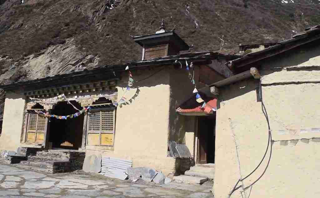
Besides that, you can also view the Tibetan villages of the region, including Chokan-Paro. The Tsum valley continues towards the Nele village. There you can also find Guru Milarepa meditation cave. Buddhist saints arrived in the area around the 11th century.
Nele – Mu Gompa
Mu Gompa altitude: 3,760 m
Trek duration: 4 hrs
Overnight: Mu Gompa
The trail of this trek starts from Nele and leads you to Mu Gompa. You will traverse through the Tsum Valley to arrive at Mu Gompa. Mu Gompa is the oldest and quite significant monastery in the region. We will then travel to the high-altitude terrains observing the incredible snow-clad mountains in all directions.
You can observe the beautiful natural vista before arriving at the Mu Gompa, where you will rest for the night. You can explore and follow antique relics, idols, and statues in the monastery region. Mu Gompa is also located at the highest elevation in the Tsum Valley.
Mu Gompa – Rachen Gompa
Rachen Gompa altitude: 3,240 m
Trek duration: 5 hours
Overnight: Rachen Gompa
One of the most beautiful trails of this trek is the one to Rachen Gompa. The high-altitude trail of this trek takes you to the beautiful Rachen Gompa in the Tsum valley region. The course also provides you with the entire snow-capped region panorama. You will pass through yaks herding in the area and herders on your way to Rachen Gompa.
Rachen Gompa – Chumling
Chumling altitude: 2,386 m
Trek duration: 6 hours
Overnight: Chumling
The trek section on this trail will finally take you to Chumling. After breakfast and observing the best views of the entire region, you will start the tour. You will then pass through the green vegetation of the region. After trekking for some time, you will finally arrive at the Chumling village. There you can stay at a teahouse in the region.
Chumling – Lokpa.
Lokpa altitude: 2,240 m
Trek duration: 5 hours
Overnight: Lokpa
From this beautiful destination in Chumling, you will have breakfast and continue your journey. The incredible trail of this trek passes through the beautiful course to arrive at Lokpa. The path of this trek will pass through the valley route. The trail then descends to the beautiful Tsum valley region. There are incredible landscapes in the area that are outstanding. You will stay in a Lokpa teahouse.
Lokpa to Namrung
Namrung altitude: 2,700 m
Trek duration: 5 hours
Overnight: Namrung
On this trekking day, you will continue your journey to Namrung. It is a beautiful settlement where you can observe the incredible mountain vista. There is a lovely village settlement of Bihi along the way. There is a Tibetan settlement of the local people with unique Buddhist culture and heritage.
We will trek for another 2 to 3 hours before arriving at the steep valley. There are many prayer wheels and stone walls on our journey to Ghap, where we will stop for lunch. There are different water streams along the route to the Lidana glacier.
From this viewpoint, you can observe the Kutang (Manaslu) Himal range, Pang Phuchin (6,335m), Saula Himal (6,235m), and other 6000 m snow-clad mountains. The beautiful gradual uphill terrains lead you to the beautiful settlement of Namrung (Sho Namur).
Namrung – Lo-Gaon
Lo- Gaon altitude: 3,180 m
Trek duration: 5 hours
Overnight: Lo-Gaon
We will begin trekking on our day early in the trek to Lo-Gaon. The beautiful terrain passes through farm fields and yaks grazing pasture lands.
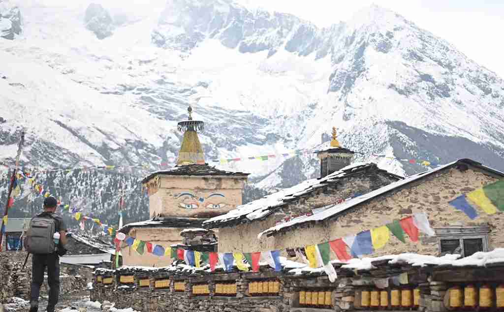
From the viewpoint along the trail, you can observe the North-face of the Manaslu mountain. The village also has a monastery with main walls and prayer flags. You can also observe the beautiful Ganesh Himal from the viewpoint nearby.
Lo-Gaon – Sama-Gaon
Sama Gaon altitude: 3,530 m
Trek duration: 5 hours
Overnight: Sama-Gaon
On this trekking day, you will travel through the comfortable trails to arrive at the village of Sama-Gaon. You will need to climb high-altitude routes and observe during the course. The trekkers will trek for 2-3 hours before arriving at the Shala village.
The beautiful Manaslu and Himal Chuli make the trek a fantastic adventure. We will walk for a few hours before arriving at the Sama-Gaon village, with majestic views of Mt. Manaslu.
Sama-Gaon – Samdo (3,690 m)
Samdo altitude: 3,690 m
Trek duration: 5 hours
Overnight: Samdo
After observing the stunning mountain vista, you will continue your trek in the high-altitude Himalayan region. It takes around 2-4 hours to arrive at Samdo, the last settlement in the area.
The high-altitude climb passes through the dry landscapes of the region before arriving at the destination. The region’s scenic beauty includes outstanding views of the snow-clad mountains.
Walking slowly with breaks and enjoying surrounding peaks and dramatic landscapes is ideal on these terrains. After walking for a few hours, we reach a small plateau of Samdo.
Samdo – Larkya Phedi/Dharma-Shala
Larkya Phedi altitude: 4,470 m
Trek duration: 5 hours
Overnight: Larkya Phedi
This section of the trek takes you through the incredible Larke Phedi. Its beautiful settlement provides you with amazing views of Mount Manaslu. These landmarks offer you stunning views of the local settlements. Kutang is the local name of the mountain in the Tibetan language.
There are the icy streams that you will cross at Larke Phedi. It is also known as Dharmasala. You need to take long climbs before arriving at the destination. After arriving at the destination, You can explore the region in Larke Phedi and spend the night in a teahouse.
Larke Phedi – Larke La Pass – Bhimthang
Larkya La Pass altitude: 4,470 m
Trek duration: 7 hours
Overnight: Bimthang
On this day of the week, you will cross the majestic Larkya La Pass, situated at 5214 m. The beautiful rugged terrains include rocky moraines and boulders. Finally, you will arrive at your destination, crossing through the north Larke glacier. You can observe Cho Danda and Larke Peak during the journey.
The gradual trekking leads you to the mountain pass with Buddhist prayer flags. Himlung, Annapurna II, Cheo Himal, Kang Guru, and Manaslu peaks are the highlights of this section of the trek. We will rest at Bimthang in the region.
Bimthang – Dharapani
Bimthang altitude: 4,470 m
Trek duration: 7 hours
Overnight: Dharapani
We begin our walk from Bimthang. We will then trek uphill to the region and arrive at the Gho and Dharapani. The trail passes through the thick alpine forests of the area.
The wooden trail arrives at the Gho, where you can find yaks and yak herders. The trail downhill terrain then treks you to the forested area alongside the Mardi River. We will climb uphill in the region to arrive at the Dharapani village after crossing a bridge.
Dharapani – Chamje – Besisahar.
Chamje altitude: 1,460 m
Drive duration: 2 hours
Trek duration: 6 hours
Overnight: Besisahar
Our trek from Dharapani will pass through the beautiful forested trails leaving Manang. The walk passes through the last village of Tal in Manang district before entering Lamjung district.
The trail then leads you through the forested trail to cross the Marsyangdi River and arrive at Chamje. We will finally take a scenic drive to Besisahar, the district’s headquarters. We will explore the region and then rest in a lodge.
Besisahar – Kathmandu
Kathmandu altitude: 1400m
Drive duration: 6-7 hours
Our trip starts with a scenic drive from Besisahar back to Kathmandu. The scenic drives provide you with incredible views of the entire region. The exciting journey back to Kathmandu takes around 6-7 hours.
You may also like:
- Manaslu Circuit Trek Guide
- Manaslu Circuit Trek Difficulty
- Manaslu Trek Permit
- Manaslu Circuit Trek Distance
Raj is the co-founder of Mosaic Adventure who have immense knowledge of all the trail throughout Nepal. Working on the trekking industry for more than three decades Raj knows the country like back of his hands. If you need more information or help to plan any trips to Nepal, feel free to get in touch with Raj through his email [email protected] or whatsapp him on +9779851090836.