The Manaslu trek 12 Days is the perfect itinerary for walking across the untouched Manaslu region of Nepal.
It is a remote and off-the-beaten-track with beautiful views throughout the trek. During this trek, you will get to the base of the 8th highest mountain in the world i.e Mt. Manaslu.
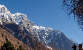
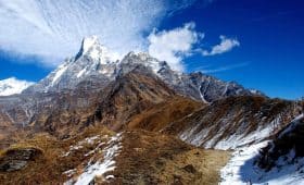
The most adventurous and challenging part of the trek is crossing the Larkya La Pass. This pass is also a vantage point to witness breathtaking snow-capped mountain peaks.
The Manaslu Circuit Trek also offers amazing views of the natural scenery, diverse landscape, biodiversity. And, the epic suspension bridges make your photos and the trip fascinating as well as absolutely memorable.
The local inhabitants and their unique lifestyles, cultures, and traditions are also some major attractions.
Now let us guide you to the detailed itinerary of our 12 days Manaslu trek down below.
Table of Contents
- Highlights of Manaslu Trek 12 Days
- Detailed Itinerary of Manaslu Trek 12 Days
- Day 01: Kathmandu to Soti Khola
- Day 02: Soti Khola to Machha Khola
- Day 03: Machha Khola to Jagat
- Day 04: Jagat to Deng
- Day 05: Deng to Namrung
- Day 06: Namrung to Samagaon
- Day 07: Acclimatization Day at Samagaon
- Day 08: Samagaon to Samdo
- Day 09: Samdo to Dharamsala
- Day 10: Dharamsala to Bimthang
- Day 11: Bimthang to Dharapani
- Day 12: Dharapani to Kathmandu
- FAQs
- Some Useful Tips for the Trek
- Conclusion
Highlights of Manaslu Trek 12 Days
- Encounter the remote and off-the-beaten-path of Manaslu region
- Pass through rhododendron, pines, hemlock, and oak tree lines
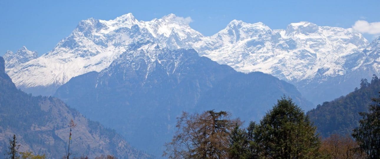
- Great vista of Mt. Manaslu, Annapurna I, Annapurna South, Gangapurna, Machhapuchhre, and Annapurna III
- Beautiful cultural combination of local Nepalese and Tibetan originated Nepalese people
- Manaslu Base Camp and the Manaslu glacier
- Crossing Larkya La pass (5153m/16901ft)
- Majestic Budhi Gandaki River valley
- Tatopani- a natural hot spring
Want more information? Send us your query, and our experts will get back to you within 24 hrs.
Detailed Itinerary of Manaslu Trek 12 Days

Day 01: Kathmandu to Soti Khola
Altitude: 710m, Soti Khola
Travel hour: 8 hours
Your journey starts today with 8 hours drive from Kathmandu to Soti Khola. At first, the journey is smooth as you go through the highway. You will encounter an amazing view of terrace farms, villages, and hillocks on the way.
However, from Gorkha the path gets rough. Upon reaching Arughat, you will take some rest before changing the vehicle to go to Soti Khola.
Soti Khola is approx 13 km away from Arughat and is the starting point of the trek.
Overnight at a lodge in Soti Khola.
Day 02: Soti Khola to Machha Khola
Altitude: 900m, Machha Khola
Trekking duration: 5 hours
Your actual trek begins today. Machha Khola is 15km away from Soti Khola and it will take around 5 hours to reach there.
Just a little further from Soti Khola, you will come across an army’s lighting camp. And from there you will walk till you reach the place named Khursani Baari.
From the opposite side of Khursani Baari, you can view the 100m waterfall. Walking on the same side will lead you to Machha Khola. In this area, you will witness the landslide view from the massive earthquake of 2015.
Here you will find very few houses around 20 -30 with 4 popular hotels. Overnight at a lodge in Machha Khola.
Day 03: Machha Khola to Jagat
Altitude: 2095m, Jagat
Trekking duration: 6-7 hours
Today after the permit checking in the police checkpoint in Machha Khola, you will continue your trek towards Jagat. You will trek through up and down trails and also climb a steep uphill trail. This takes you to Tatopani.
Tatopani is a hot spring site where you can enjoy a bath in the hot spring. This will help to relax your muscle and joints.
From here you will have a horizon view of cantilever bridge from Yaru Bagar which will take 20 minutes to reach there. This bridge is 158 m long and is the first bridge of the kind in Nepal.
After trekking a distance of about 22 km for approx 7 hours, you will reach Jagat. Jagat is the entry checkpoint of Manaslu Conservation area.
Overnight in the beautiful village of Jagat.
Day 04: Jagat to Deng
Altitude: 1340m, Deng
Trekking hours: 6-7 hours
After the permit check-in upper Jagat, you will continue your trek early in the morning. It is about 7 hrs walk to Deng village which consists of just around 4 houses and 3 hotels.
On the way to Salleri after about 40 minutes of walk, you will need to cross one river. Here you will see two hydro-powers (one new and one old).
Further, you will walk from Salleri to Sirdibas, overviewing the mountain named Siring. Later you will cross a bridge and walk for about 15 to 20 minutes where you will reach Philim. The place has different administrative offices, land revenue office, police stations and many more.
From Philim, you will trek to Chisapani where you will have your lunch. Later you will take the path towards Nayak Phedi and proceed to Pewa which will take about one and a half hour to reach.
In Pewa, you will cross a suspension bridge twice which will be a nice experience. From Pewa to Deng, it is 45 minutes walk.
Overnight stay in Deng.
Day 05: Deng to Namrung
Altitude: 2900m, Namrung
Trekking duration: 6-7 hours
After breakfast, you will start your trek early in the morning. You will walk the trail downhill to Budhi Gandaki river. And uphill to Rana gaon where you will get the view of beautiful landscape and river.
About 45 minutes walk from Rana gaon, you will reach Bhimphedi. From there you will walk towards Gap village where you will have your lunch.
After the lunch, you will continue your trek for about 1 hour through the dense forest, dead pine trees and many more.
Later you will reach Suksum and from there you will climb to Namrung which will take about 1 and a half hour. In Namrung you will find a resort. The room at the resort cost around USD 35 for room and extra for food.
Overall, Namrung is approx 21 km away from Deng and will take about 7 hours to reach.
Overnight stay at Namrung.
Day 06: Namrung to Samagaon
Altitude: 3500m, Samagaon
Trekking duration: 6-7 hours
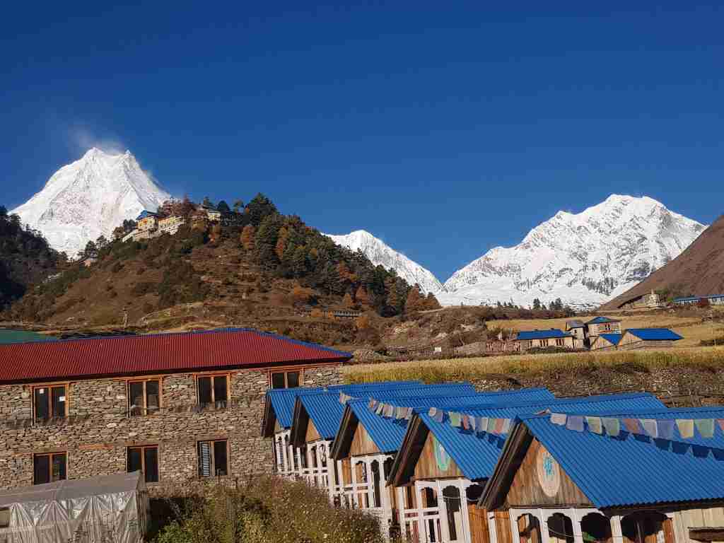
Today, you will walk to the beautiful village of Samagaon. To reach Samagaun from Namrung, you will pass through the places like Banjam, Lihi, Sho, Lho, and Sayla.
On the way, you will cross the Budhi Gandaki river, walk through the alpine forests, stone arch, Chortens, and barley terrace fields.
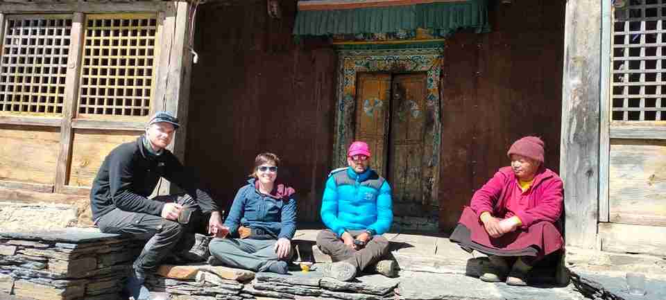
Once you reach Lho, you can rest and have lunch. Here you can explore the Buddhist monastery. Also, you will have great views of the Himalayas.
From here the path towards Lihi is steep. You will continue your trip towards Sho to Lho which will take 1 and a half hour plus 2 hours to reach Syala. From Syala, it will take another 1 hour to reach Samagaun.
In Syala you will get the panoramic view of the north Himalchuli, Nadi Chuli Manaslu, Saula Himal, and Siringi Himal. You will also get to see a real yak. It is also a popular place for commerce and is the route to Manaslu Base Camp.
Overnight at the beautiful village in Samagaon.
Day 07: Acclimatization Day at Samagaon
Altitude: 3500m
Today is the rest day in Samagaon. You can spend the day sitting in the hotel and roaming around in surrounding. But if you prefer to hike you have three options. You can visit Birendra Taal which is 3km from Samagaon, Base Camp or the Pungen monastery.
Base Camp is 6 km far and will take about 5 hours to reach there. It is at an elevation of 4800m. From here you can also view Manaslu glacier.
The Pungen monastery is 6- 7 km far from your acclimatization spot. This place gives a better panoramic view of Mt. Manaslu and its neighboring peaks than the Base Camp.
Overnight stay in Samagaon.
Day 08: Samagaon to Samdo
Altitude: 3690m, Samdo
Trekking duration: 4 hours
From Samagaon village first, you will walk for around 3 hours across a steep hill and proceed on flat land for 15 minutes walk before you reach the destination- Samdo.
Samdo is a Tibetan refugee village at the height of 3800m. On this day, you will trek through beautiful juniper and birch forests to the base camp.
Once here, you will witness the awe-inspiring mountains. Added, you will get one of the clearest views of Mt. Manaslu.
You will trek around 16 km today. Overnight stay at Samdo.
Day 09: Samdo to Dharamsala
Altitude: 4450m, Dharmasala
Trekking Duration: 4 hours
Today’s trek starts with a downhill trek up to Budhi Gandaki river. You will then cross the river and again climb upwards through Larkya Bazaar and valley of Salka Khola towards Dharamsala.
Dharamsala is also known as Larkya Phedi. It is 12km away and will take about 4 hours to reach. You will come across the magnificent Larkya Glacier today.
Overnight stay at Dharamsala.

Day 10: Dharamsala to Bimthang
Altitude: 3720m, Bimthang
Trekking duration: 8 hours
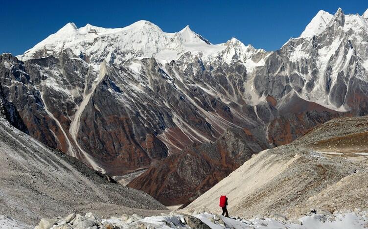
Today you walk to the highest point of your Manaslu trek 12 days. It is the famous and most challenging part i.e the Larkya La Pass at 5213m.
Here you will get the best views of the Himalayan ranges. You can witness Mt. Annapurna II, Cheo Himal, Kang Guru, and Himlung Himal.
After crossing the pass, you will move down towards a grassy moraine. The trail then becomes easier from there.
Further trek of about 6 hours will lead you to the beautiful village of Bimthang. With this, you cover a distance of 25km.
Overnight stay at Bimthang.
Day 11: Bimthang to Dharapani
Altitude: 1860m, Dharapani
Trekking duration: 7-8 hours
This is the last and one of the longest days of your actual trek. Today you will cover a total distance of 34km.
However, after crossing the pass and reaching the base camp, this part of the trek will seem easy.
Dharapani extends from Gorkha to Manang district. On the way, you will pass through Karche, Goa, Tilche and finally reach Dharapani.
The trail descends to Dudh Khola river. You will trek through deep pine forest and forests of rhododendron.
From here you will also get an amazing view of the Marsyangdi valley. Then you will reach Tilije, the Gurung village that is famous for its local made brandy.
Here you will come across various police checkpoints till you reach Dharapani. It is the entry point of the popular Annapurna Circuit trek.
Overnight stay at Dharapani.
Day 12: Dharapani to Kathmandu
Altitude: 1440m, Kathmandu
Trekking hours: 7-11 hours
Today is the last day of your trek. From Dharapani you will catch a jeep and drive to Besisahar. Again from Besisahar, you will drive on the bank of Marsyangdi river to reach Kathmandu.
It is a 7- 11 hrs journey by road. You will cover a distance of 377 km on this day enjoying the beautiful view of the green forest, small houses, and huts, bridges etc.
Overnight at a hotel in Kathmandu.
With this, you come to an end of an amazing 12 days Manaslu trek.
FAQs
How Difficult is the Manaslu Trek 12 days?
The 12 days Manaslu trek is a moderately strenuous trek. This is partly due to the duration which is short.
However, you don’t have to be an expert climber to do this trek. But it is wise to prepare yourself physically as well as mentally before taking this trek.
During this trek, you need to be able to walk for about 6-7 hrs every day. The trails can get rocky and uneven with up and down walks. Hence, it is important that you have a moderate fitness level so that you can complete the trek comfortably.
When is The Best Time to Take the Trek?
You can enjoy the trek at any time of the year. However, the best time to do the Manaslu trek is Spring (March, April, May) and autumn (September, October, November).
This is because the weather condition during this time is slightly stable and cool.
Spring is popular for climbing to the peak of Manaslu. Moreover, it sees the blooms of the flowers in the lower regions.
While Autumn is another great time to trek to this region. The temperature is just right that supports your trek. During this time you will enjoy the spectacular views of landscape and glorious mountains.
Trekking in summer to this region is great for the adventure lovers. The trails can get muddy and slippery with insects like mosquitoes and leeches. Yet, nature is at its best. In summers you can spot beautiful rainbows in the Himalayas with clear blue skies.
Winters are cold esp in the Larke La Pass which may remain closed due to bad weather and for safety. However, this season also gives you magnificent and clear views of the snow-covered mountain peaks.

What are The Necessary Permits?
To do the Manaslu trek you will need the following permits.
- Manaslu Restricted Area Permit
- Manaslu Conservation Area Permit (MCAP)
- Annapurna Conservation Area Permit (ACAP)
- Manaslu Tsum Valley Trek restricted permit (if you wish to join the side-trip to the Tsum valley)
Note: You do not need TIMS card (Trekking Information Management System) for this trek.
Are Solo Treks to Manaslu Region Possible?
You cannot take a solo trek in the Manaslu region. The Manaslu region lies in the restricted region of Nepal. Hence the government of Nepal does not allow solo treks in this region.
To trek here you need to have groups of at least 2 including a local trekking staff.
Here you have the option of hiring one or more local trekking staff. The local trekking staffs are your guide and porter.
Also, be sure to check that your guide has the professional license required to do the job.
Some Useful Tips for the Trek
- Choose a suitable season and pack accordingly
- Train yourselves physically and mentally prior to the trek
- Hire a professional guide or porter for safe and comfortable trekking experience
- Do not rush and maintain your own pace
- Drink plenty of water to minimize the risk of altitude sickness
- Keep extra days for any unplanned situation
- Carry enough cash as there are no ATMs in the mountains
- Always reach out for help in case of any problem and take the necessary precautions.
Conclusion
The Manaslu trek 12 days is one of the best treks in Nepal that takes you through amazing landscapes, beautiful villages, and forests.
This trek is great for those adventure lovers who are fit and have a strong desire to immerse into the lifestyle of mountains.
Here, you will also get the opportunity to explore the various culture of the locals along the way.
For further question and queries, please feel free to contact us. It is our pleasure to guide and assist you with the best of our knowledge.
Want more information? Send us your query, and our experts will get back to you within 24 hrs.
Madhav started working as a porter in 2001 and then moved on to work as a trekking guide. After working in the trekking and tourism industry for eight years, he co-founded Mosaic Adventure in 2009.
Madhav has trekked to most of the trekking destinations in Nepal, including Everest Base Camp Trek, Annapurna Base Camp, Annapurna Circuit Trek, Poon Hill Trek, Jomsom Muktinath Trek, Indigenous Peoples Trek, Langtang Valley Trek, Mardi Himal Trek, and all of the day hikes around Kathmandu.
He has also extensively traveled to other countries such as Australia, the USA, the UK, France, Hong Kong, Japan, China, the Philippines, the UAE, Saudi Arabia, Bahrain, Thailand, Turkey, and India. Madhav is the one who answers most of your questions about trekking and tours and helps to plan your trip by giving a personal touch.